Hectares held by Forte
 CSE: CUAUC$—OTCQX: FOMNFUS$—FSE: 2OA€—
Focused Gold Project Ancash, Peru
Alto Ruri.
Historical gold from surface. A broad alteration system still open to modern exploration.
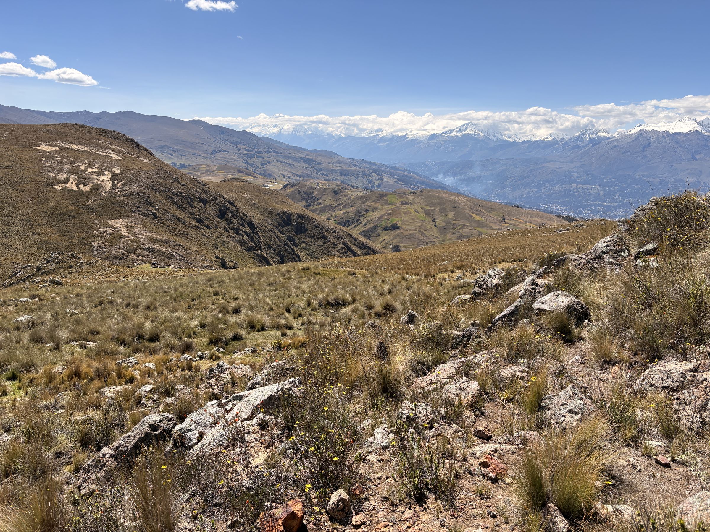
Explore the ProjectAlto Ruri, Looking North from the Discovery Hole
Alto Ruri (High Sulfidation Au)
Two Prospects.
One Strategic Position.
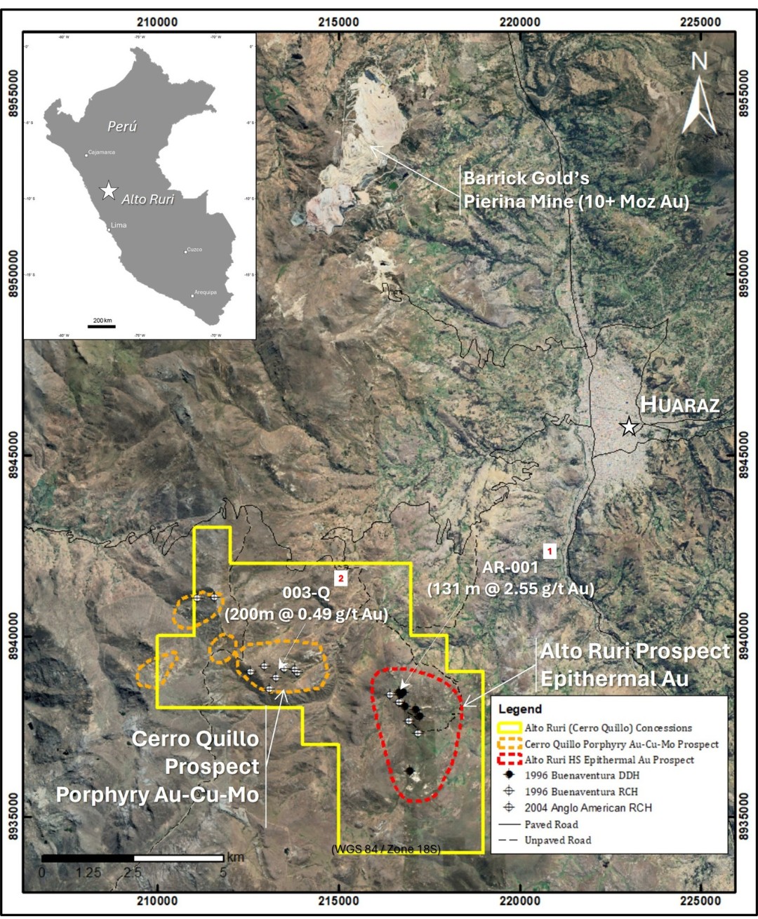
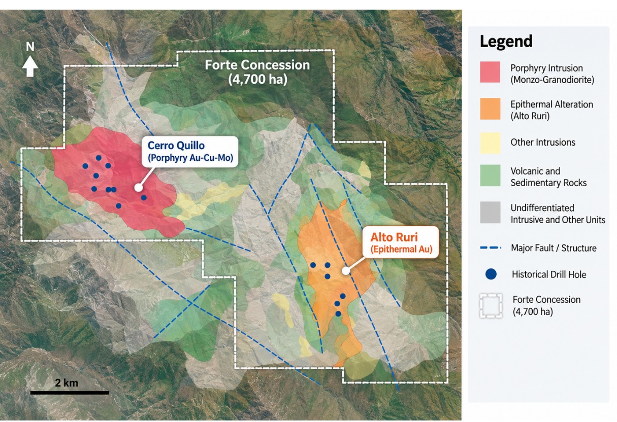
Forte’s 4,700-hectare property sits in the Cordillera Negra, 15 kilometres south of Barrick’s Pierina gold mine. The property combines the Alto Ruri high-sulfidation epithermal gold prospect with the Cerro Quillo gold-copper-molybdenum porphyry prospect three kilometres to the west.
Subject to a 1% NSR royalty
South of the Pierina gold mine
Accessible from the city of Huaraz
Qualified Person and NI 43-101 Disclosure
Richard Osmond, P.Geo., an Independent Director, is the Company’s Qualified Person (“Qualified Person”) as defined by National Instrument 43-101.
He has reviewed and approved the technical information contained on this page.
Alto Ruri
High-sulfidation gold mineralization associated with vuggy silica replacement in altered volcanic and volcanoclastic rocks.
Historically Drilled by Buenaventura · 1997Cerro Quillo
A mineralized porphyry complex with potassic alteration and a broad phyllic-argillic footprint.
Historically Drilled by Anglo American · 2004Project Summary
Summary
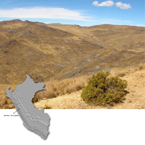
- Forte’s Concessions 4700 ha - 15 km south of Barrick’s Pierina Gold Mine.
- 100% ownership subject to a 1% NSR Royalty.
- Comprised of 2 prospects:
- Alto Ruri –High Sulphidation Epithermal Au
- Cerro Quillo – Porphyry Au-Cu-Mo
- Road accessible from the city of Huaraz
- Excellent Endowment within the Northern Peru Porphyry and HS Miocene Belt
Regional Setting
Tertiary Volcanic Arc, Northern Peru
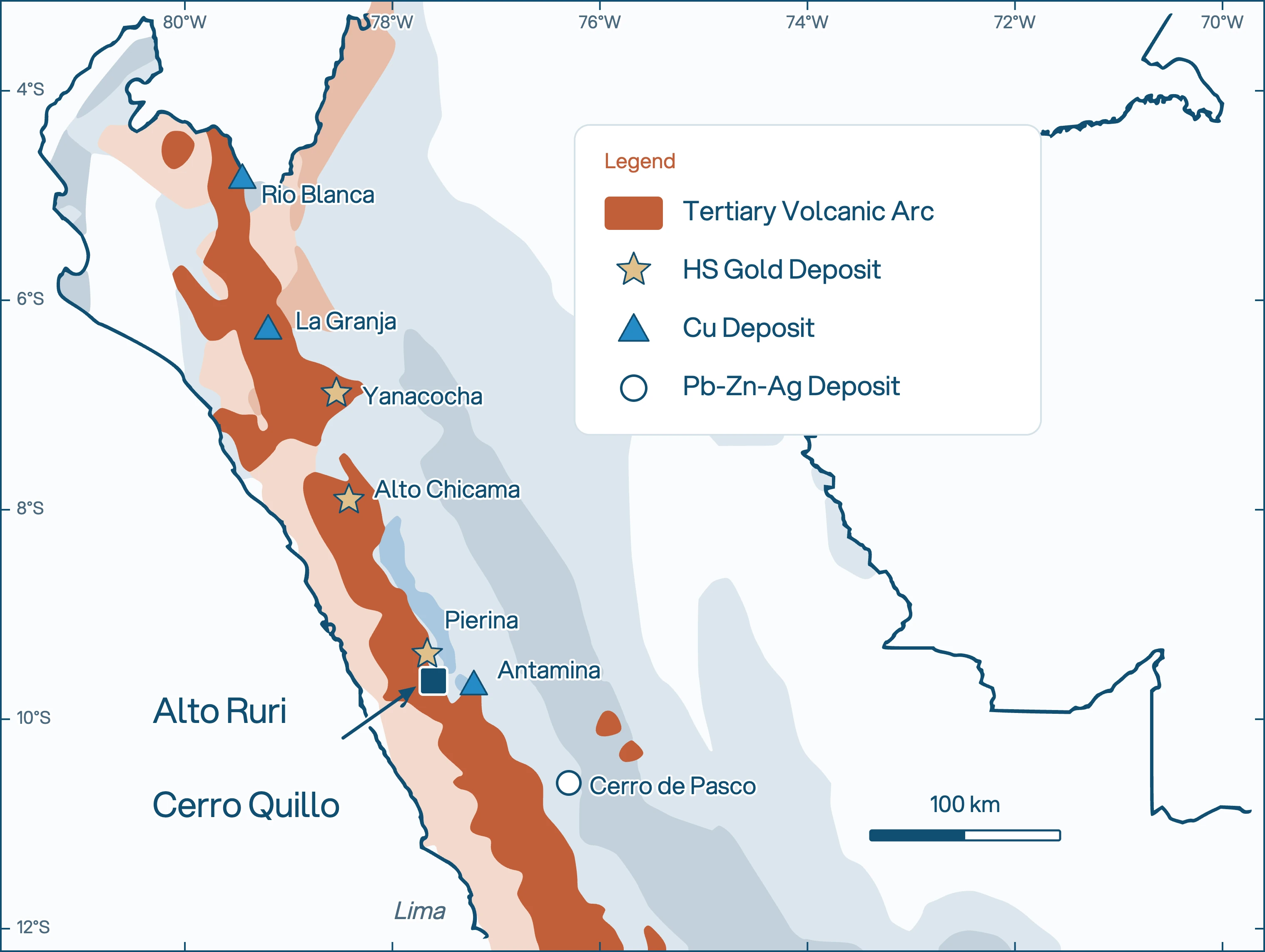
The Project is located just 15 km due south of the Pierina Au Mine owned by Barrick Gold Corp in central Perú which has produced +8 million ounces of Au since commercial production in 1999 (Figure 1). As with Pierina, these prospects are situated along the Cordillera Negra and associated with Miocene aged volcanic and volcanoclastic rocks forming part of the Tertiary Volcanic Arc which is known to host several large Miocene aged epithermal Au deposits including Newmont’s (Minas Buenaventura-Sumitomo) Yanacocha and Minas Congas deposits as well as several large Miocene aged porphyry Cu-Mo-(+Au) deposits including Chinalco’s Toromocho, Southern Copper’s Michiquillay and Rio Tinto’s (First Quantum Minerals) La Granja deposits
Alto Ruri Projects - Historical Drilling
Gold Begins
at Surface.
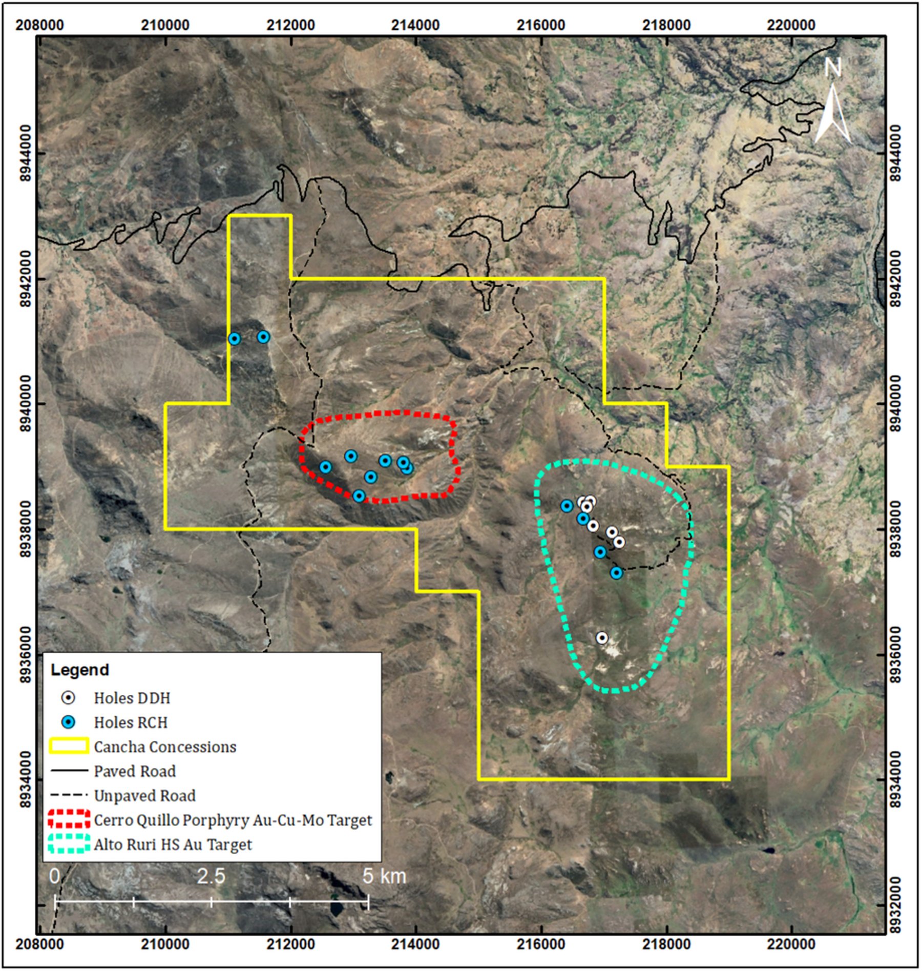
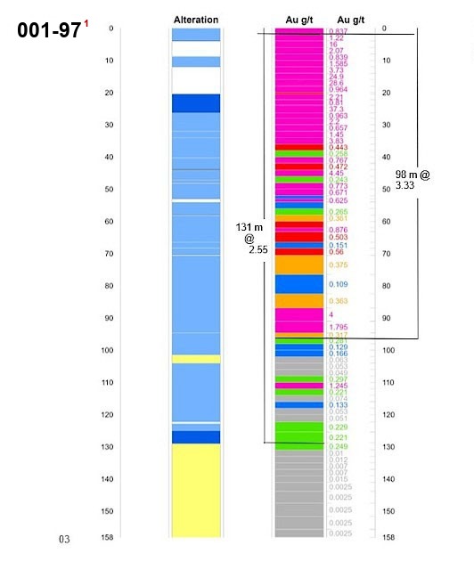
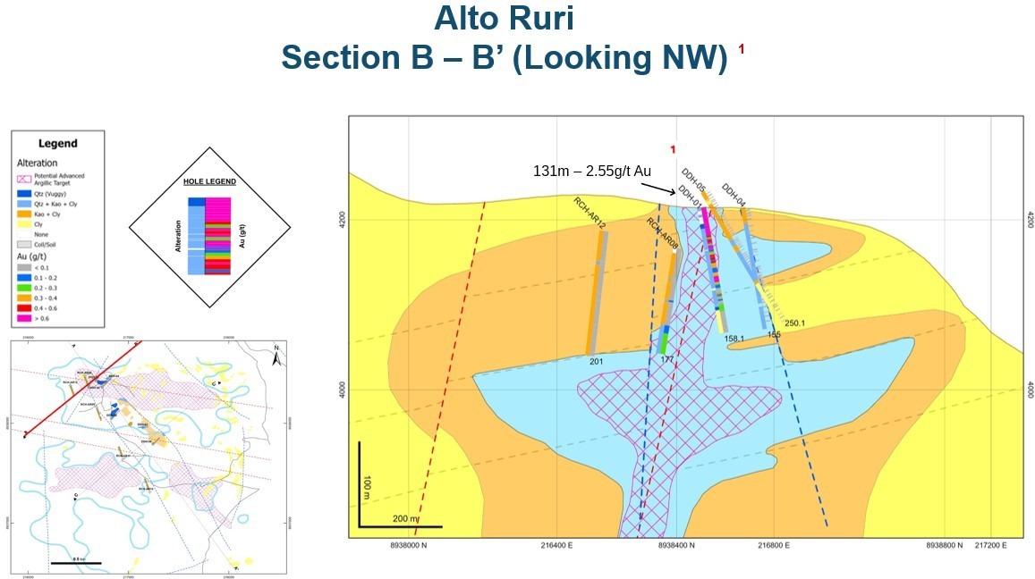
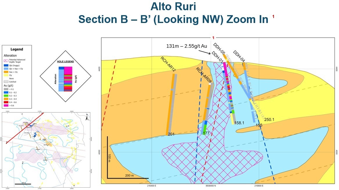
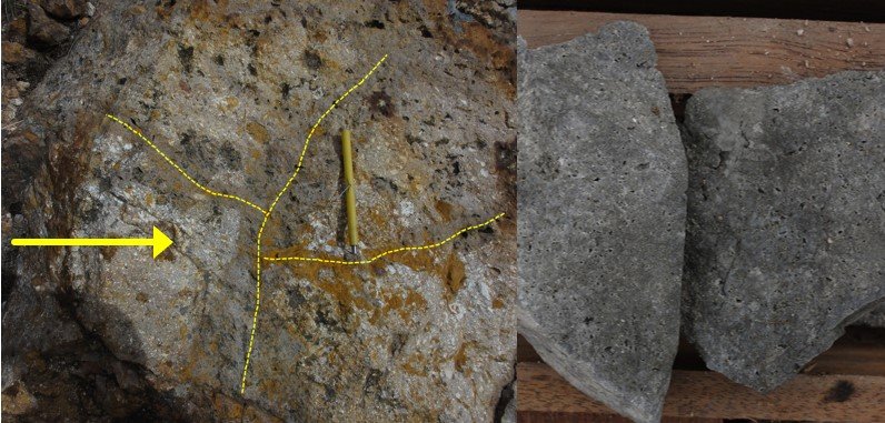
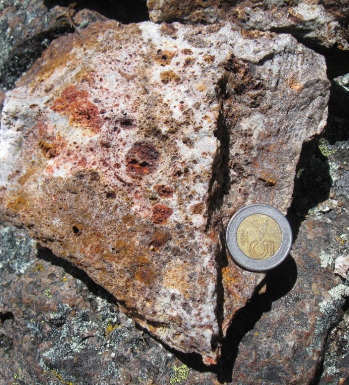
Buenaventura in 1997 who completed a two-stage, 12-hole drill program that included eight (8) NQ core and a four (4) reverse circulation drill holes totalling 2254.5 m. GlobeTrotters Resource Group Inc.’s then subsidiary Rio Marañon Minerals S.A.C. re-analysed portions of the core from the eight (8) diamond drill holes in 2011 with hole 001-97 (AR-001) returning significant Au values averaging 2.55 g/t Au over 131 m starting from surface, including 54 m of 5.39 g/t Au1 (Tables 1 and 2). The Au mineralization is associated with the vuggy silica replacement of quartz-clay altered volcanoclastic rocks typical of high sulphidation epithermal Au alteration (Figure 2) but true widths are unknown.
Including54 m at 5.39 g/t Au
The reported interval follows vuggy silica replacement of quartz-clay altered volcanoclastic rocks, a characteristic high-sulfidation epithermal setting. True widths are unknown.
Drill Data
Hole 001-97
Table 1: Assay results from diamond drill hole 001-97 at Alto Ruri.
| Hole ID | Interval (m) | From (m) | To (m) | Au (g/t) |
|---|---|---|---|---|
| 001-971 | 131 | 0 | 131 | 2.55 |
| including | 54 | 0 | 54 | 5.39 |
| including | 10 | 10 | 20 | 11.96 |
| including | 2.4 | 23.95 | 26.35 | 37.30 |
Table 2: Reported drill hole collar information (WGS84 Zone 18S).
| Hole ID | East | North | Elevation | Azimuth | Dip | Length |
|---|---|---|---|---|---|---|
| 001-971 | 216890 | 8938804 | 4215 | 45 | -70 | 158.1 |
Both Prospects
Alto Ruri – Cerro Quillo Projects - Historical Drilling
- Alto Ruri – Drilled by Buenaventura 1997
- 12 shallow holes for a total of 2254.5 m.
- 001-97 (AR-001) returned best results of 131 m of 2.55 g/t Au.
- Including 54 m of 5.39 g/t Au1.
- Cerro Quillo – Drilled by Anglo American 2004
- 9 holes for a total of 2684.9 m.
- 003-Q returned best results of 200 m of 0.49 g/t Au, 0.09% Cu, 0.007% Mo2.
Strip Log
Alto Ruri Project: Strip Log of the Best Holes AR-0011
Exploration Targets
The System Extends
Beyond the Drilling.
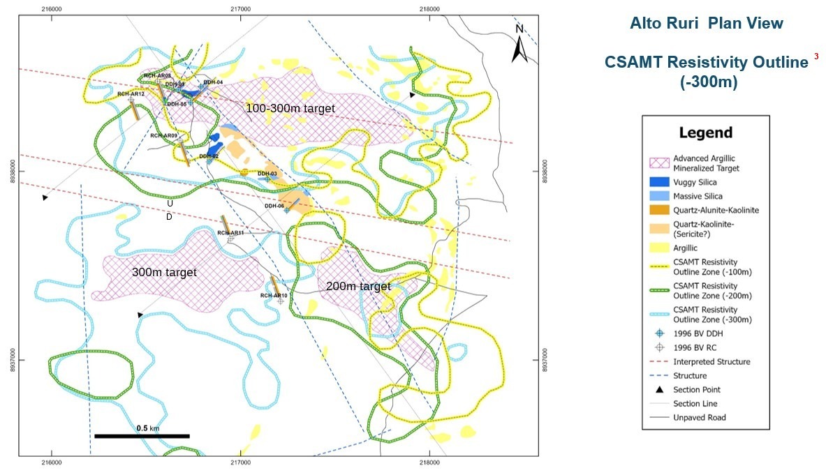
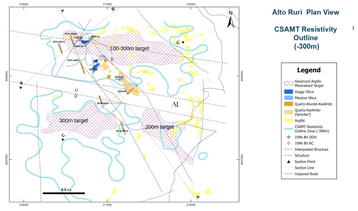
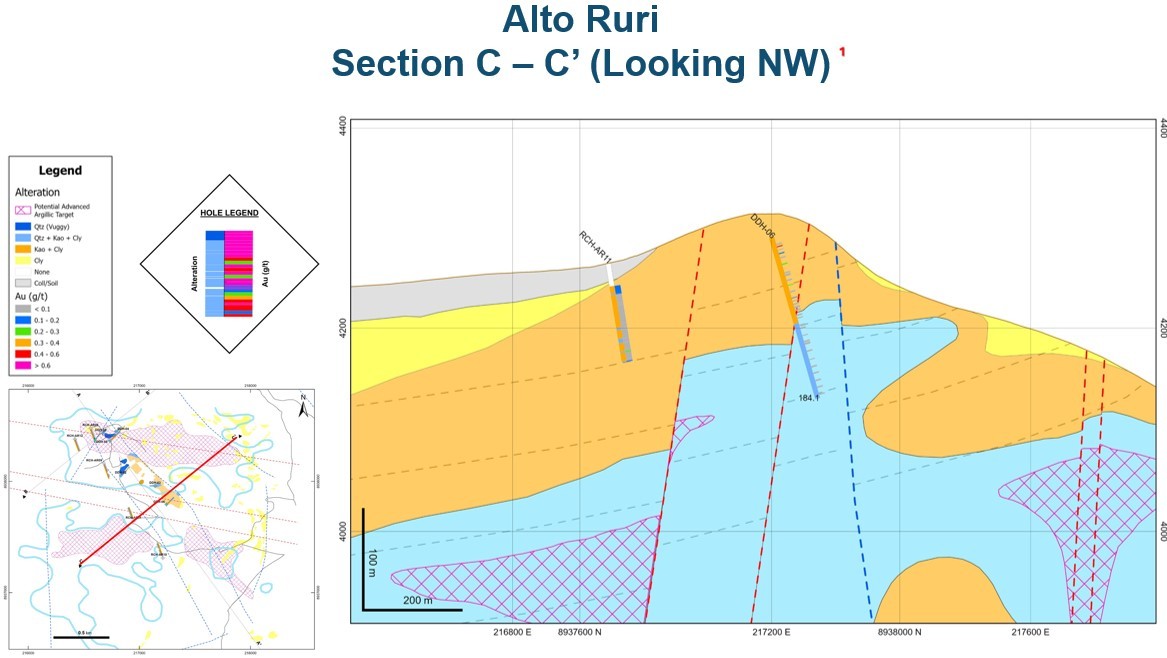
Historical resistivity and alteration work outline multiple advanced argillic targets outside the principal drill area. These datasets guide where Forte can verify historical results through drilling.
North Target100–300 m
Southwest Target300 m
Southeast Target200 m
Geophysics
Alto Ruri Plan View: CSAMT Resistivity Outline (-300m)
Sections
Alto Ruri Cross Sections
Mineral Expression
Alteration You Can See.
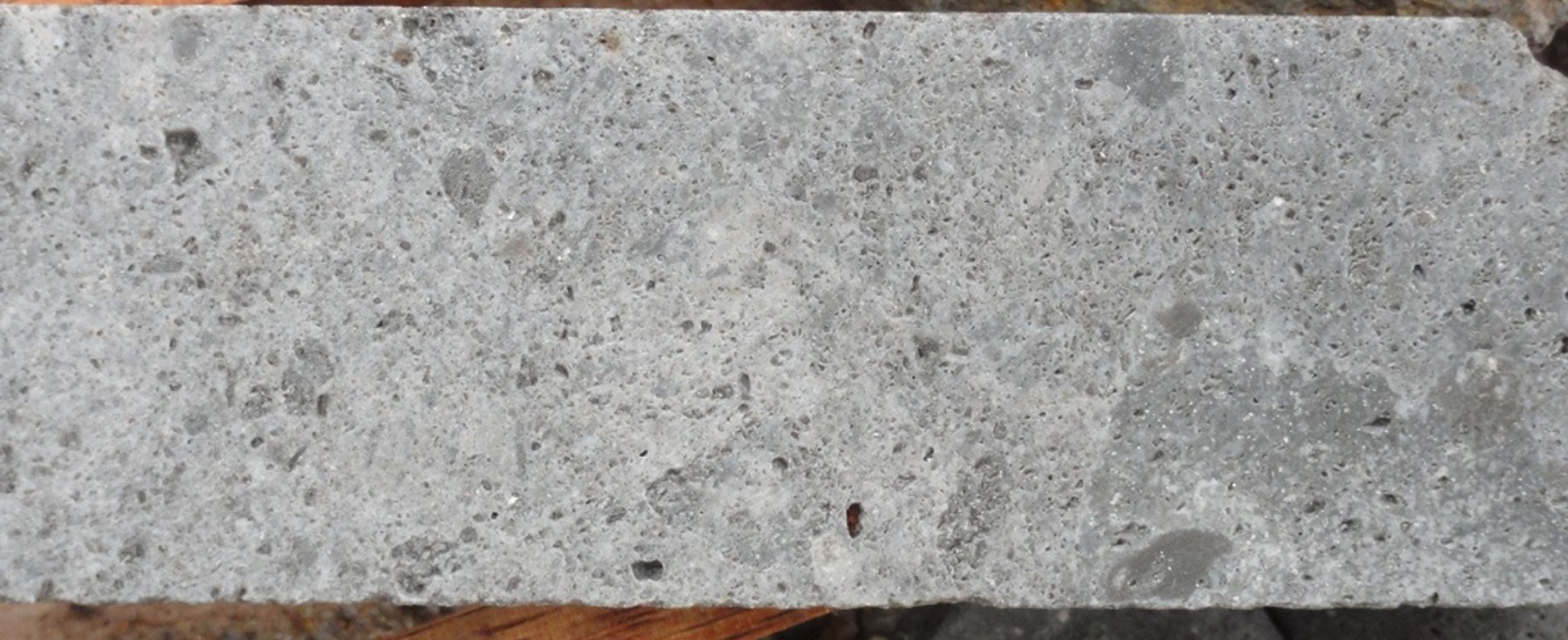
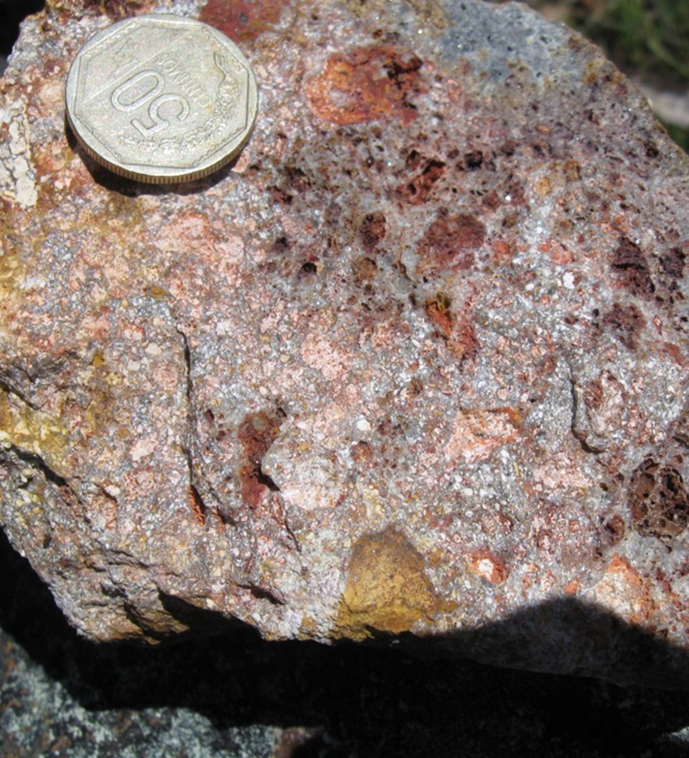
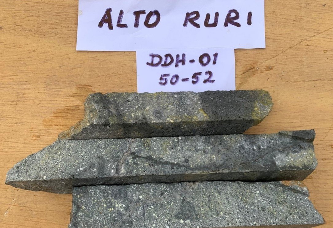
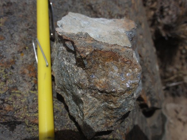
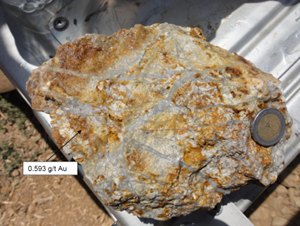
Vuggy silica is exposed in advanced argillic altered volcanoclastic rock near historical hole DDH 001-97. The texture provides field evidence of the hydrothermal system that carried the reported gold mineralization.
Rock and Core
Alto Ruri Vuggy Silica + Gold Replacement
Project Film
See Alto Ruri
in the Field.
Cerro Quillo Porphyry Au-Cu-Mo
Cerro
Quillo.
Cerro Quillo
Summary
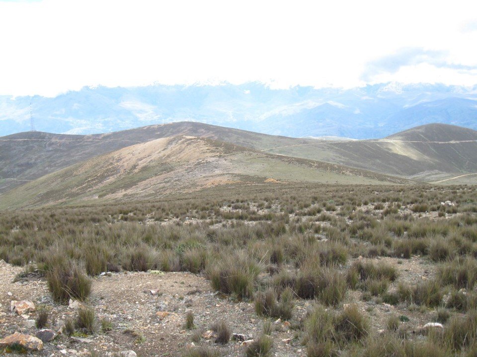
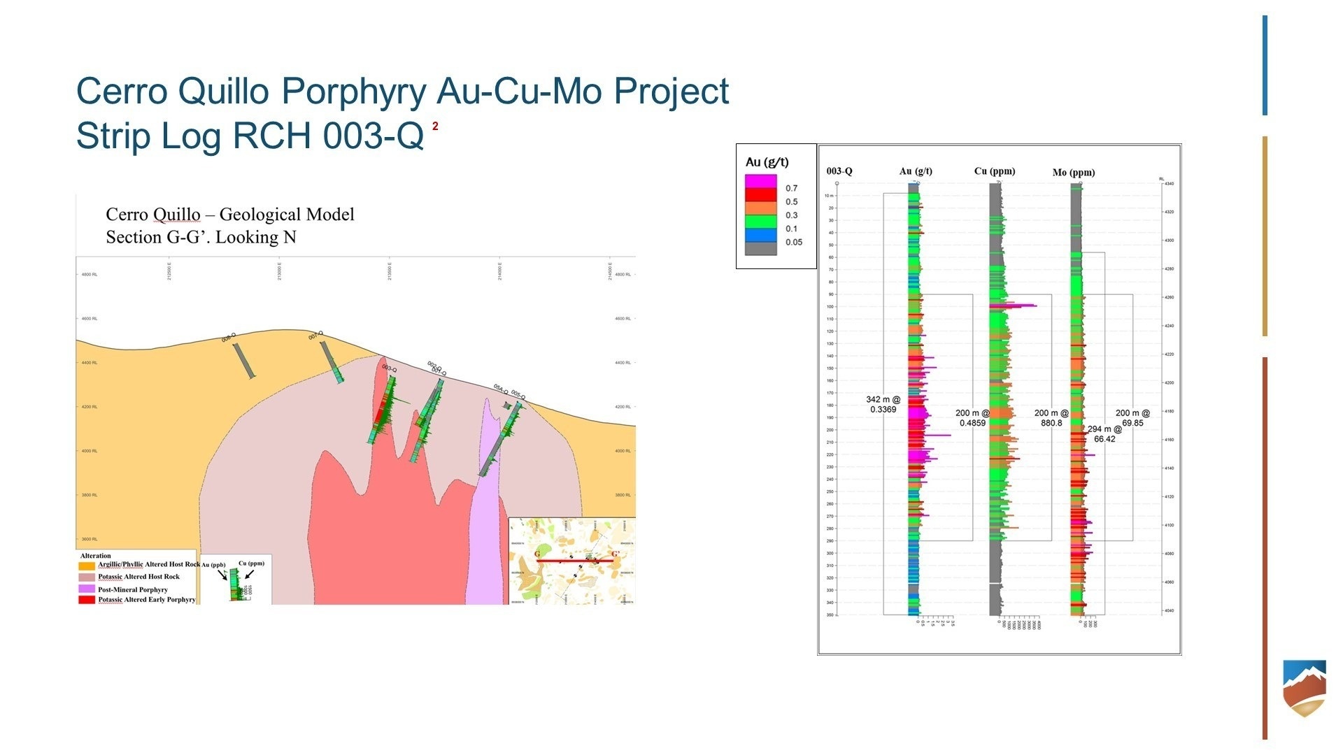
The Cerro Quillo prospect was drill tested by Anglo American Exploration Perú S.A. in 2004, which completed a nine (9) hole reverse circulation (RC) drill program for a total of 2684.90 m. The holes were drilled in the vicinity of the Cerro Quillo Porphyry Complex located three (3) km to the west of Alto Ruri. The historical assay results from hole 003-Q2 returned 200 m of 0.49 g/t Au, 0.09% Cu, and 0.007% Mo, but true widths are unknown. See Table 1 for drill hole collar information. The Cerro Quillo Porphyry Complex is a series of mineralized diorite porphyry dikes intruding Miocene aged intermediate to felsic volcanic and volcanoclastic rocks. The system is potassic altered with secondary biotite alteration, A-type and B-type veins, and local magnetite stringers overprinted by a larger 2.5 km x 1.5 km phyllic-argillic alteration zone comprised of pervasive sericite-clay alteration, D-type veins and locally disseminated tourmaline.
- Cerro Quillo Porphyry Au-Cu-Mo Project– Drilled by Anglo American 2004
- 9 holes for a total of 2684.9 m.
- 003-Q2 returned best results of 200 m of 0.49 g/t Au, 0.09% Cu, 0.007% Mo.
Historical Result · 003-Q2200 m
0.49 g/t Au · 0.09% Cu · 0.007% Mo
A Porphyry System with Scale.
Mineralized diorite porphyry dikes intrude Miocene volcanic and volcanoclastic rocks. Potassic alteration, A- and B-type veins and local magnetite stringers are overprinted by a 2.5 × 1.5 kilometre phyllic-argillic alteration zone.
Reported Collar · 003-Q
213500 E · 8939210 N · 4,340 m elevation · azimuth 325° · dip −60° · length 350.75 m
Drill Data
Hole 003-Q
Table 1 : Reported drill hole collar information (WGS84 Zone 18S).
| Hole ID | East | North | Elevation | Azimuth | Dip | Length |
|---|---|---|---|---|---|---|
| 003-Q2 | 213500 | 8939210 | 4340 | 325 | -60 | 350.75 |
Figures and Samples
Cerro Quillo Porphyry
Technical Notes
1.Rio Maranon Minerals S.A.C., in 2011, reanalyzed portions of the drill core from the eight (8) diamond drill holes completed by Compañía de Minas Buenaventura (“Buenaventura”) at Alto Ruri in 1997. These gold assay results, and drill logs were used to calculate gold assay intervals for hole 001-97 (also reported as AR-001). The Company considers these historical drill results relevant it suggest the exploration potential of the Alto Ruri gold prospects. Any future exploration work by the Company's will include the verification of the historical data through drilling.
2.The original source of the historical assay results in RC drill hole 003-Q is from a 2011 technical report prepared by Rio Marañon Minerals S.A.C. The information suggests that porphyry Au-Cu-Mo mineralization may be present in this area. The rock chip and geochemical sample reject materials from 003-Q are no longer available for re-assaying purposes. For those reasons, the historical geochemical assay results from RC drill hole 003-Q have not been verified by the Company.
3.The source of the historical geophysical data is from an unpublished 2011 technical report prepared by Rio Marañon Minerals S.A.C., which the Company has not independently verified.