Hectares across four concessions
 CSE: CUAUC$—OTCQX: FOMNFUS$—FSE: 2OA€—
Copper · Gold Central Peru
Miscanthus.
Porphyry and High-Sulfidation Exploration Targets
A 3,200-hectare property in central Peru with two copper–molybdenum–gold anomalies and a high-sulfidation gold target. The targets remain untested by drilling.
Explore the SystemProject Footprint
3,200ha
Four concessions · 100% Forte-owned
Project Overview
A Cluster,
Not a Single Target.
Miscanthus combines two porphyry copper-molybdenum-gold anomalies with a separate high-sulfidation gold-silver zone. Each target is supported by surface geochemistry, mapped alteration and coincident geophysical responses—and none has yet been drill tested.
Subject to a 1% GlobeTrotters NSR royalty
Gold, Copper East and Copper Southwest
Environmental drilling approval in place
Qualified Person and NI 43-101 Disclosure
Richard Osmond, P.Geo., an Independent Director, is the Company’s Qualified Person (“Qualified Person”) as defined by National Instrument 43-101.
He has reviewed and approved the technical information contained on this page.
Summary
Miscanthus (Porphyry Cu-Mo-Au and High Sulfidation Epithermal Au)
- Commodity
- Copper · Gold
- Project Type
- Porphyry and High-Sulfidation Exploration Targets
- Area
- 3,200 ha
- Status
- DIA Approved
- 01
3,200 ha property acquired from GlobeTrotters for USD $27,000 and 3,000,000 Forte shares.
- 02
100% owned by Forte.
- 03
Features two Cu-Mo-Au geochemical anomalies, both spanning 3 x 1 km, and a high-sulfidation gold anomaly >1 x >0.5 km.
- 04
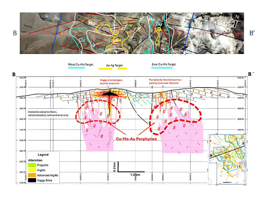
Highly prospective for a cluster of telescoped porphyry Cu-Mo-Au systems and overprinted high-sulfidation epithermal Au-Ag.
- 05
Untested by drilling. Geophysical anomalies (high resistivity and chargeability) are strongly associated with these targets.
- 06
DIA drilling permit (valid for five years) received in March 2022.
Location
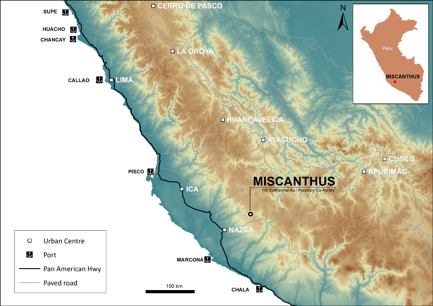
Western Cordillera of Central Peru.
The Miscanthus property is situated in the Western Cordillera of Central Peru, approximately 375 km southeast of the Toromocho Porphyry Cu-Mo deposit (Chinalco).
- Access
- 447 km from Lima to Nasca (7 hours), with an additional 120 km (3 hours) to the property. Alternative access via Lucanas, Sacsamarca, and Otoca.
- Elevation
- 3,950–4,200 m above sea level.
- Infrastructure
- 120 km from Marcona Port and near the Mantaro-Southern Peru power grid.
Geology
Three Expressions.
One Telescoped System.
Miscanthus lies within the Miocene porphyry Cu-Au-Mo/epithermal Au belt of Central Peru, known for hosting significant deposits such as Toromocho, La Granja, and Lagunas Norte.
01
High-Sulfidation Au-Ag
High-Sulfidation Epithermal Au Target
>1 x >0.5 km alteration zone
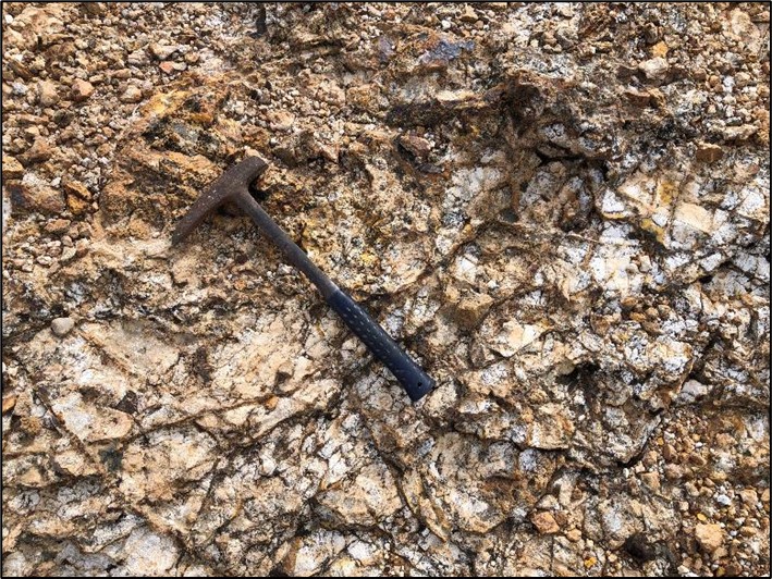
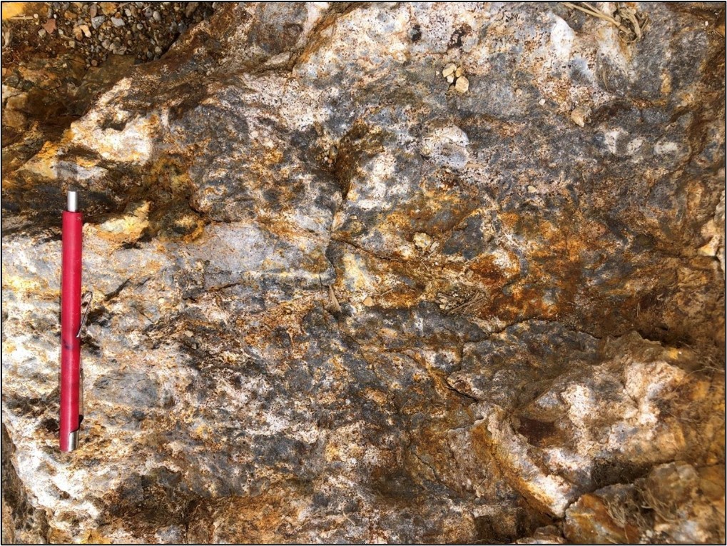
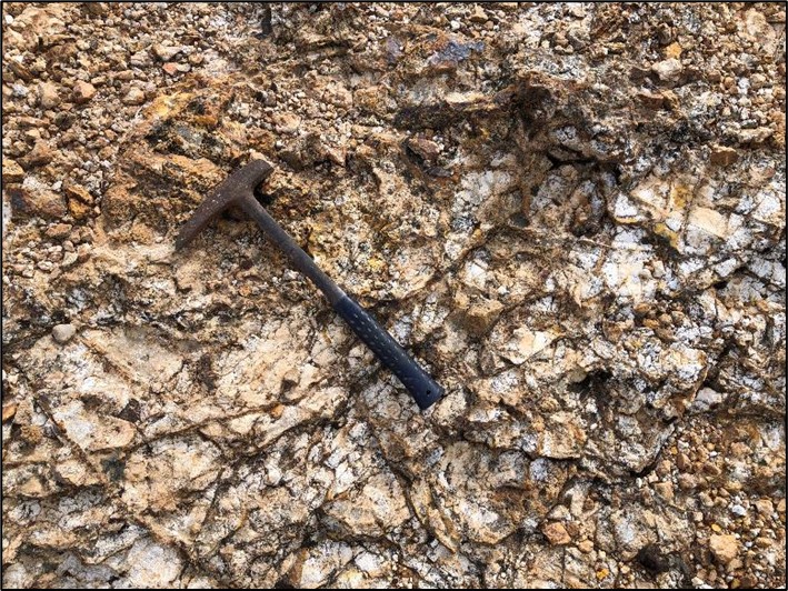
- Structurally controlled silica ledges and vuggy silica bodies.
- Associated with a >1 x >0.5 km quartz-alunite-kaolinite alteration zone.
- Coincides with significant geochemistry anomalies, including up to 193 ppb Au and 8.9 ppm Ag.
Gold in Surface SamplesUp to 193 ppb Au
Silver in Surface SamplesUp to 8.9 ppm Ag
Key Prospect · Gold Target ZoneExtensive resistivity anomaly coinciding with gold-in-soil anomalies.
Copper-Molybdenum Targets
02
Porphyry Cu-Mo-Au
Copper Target East
Part of a 3 x 1 km Cu-Mo-Au anomaly
- Features alunite-pyrophyllite worm textures indicative of proximity to a Cu-Mo porphyry system. Associated geochemistry includes 133 ppm Cu and 21 ppm Mo.
Associated Copper133 ppm Cu
Associated Molybdenum21 ppm Mo
Key Prospect · Copper Target EastSignificant lithocap alteration and porphyry system indicators.
03
Porphyry Cu-Mo-Au
Copper Target SW
Part of a 3 x 1 km Cu-Mo-Au anomaly
- Hosts silica-sericite-pyrite outcrops with up to 10,000 ppm Cu and 464 ppm Mo, suggesting a potential deeper porphyry system.
Surface CopperUp to 10,000 ppm Cu
Surface Molybdenum464 ppm Mo
Key Prospect · Copper Target SWStrong geophysical anomalies associated with Cu-Mo-Au mineralization.
Integrated Evidence
The Layers
Line Up.
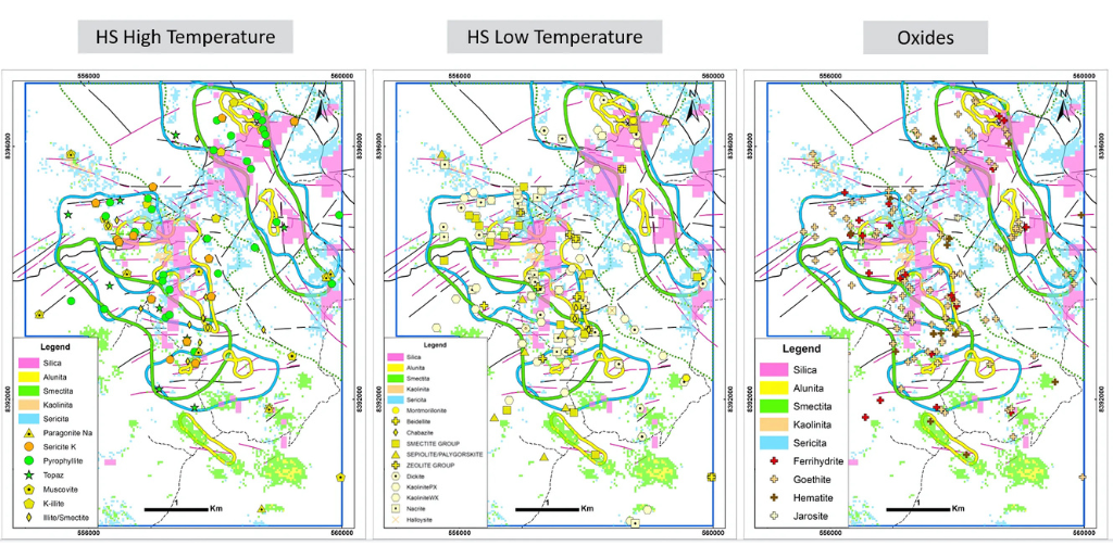
Geochemistry, alteration mineralogy, magnetics, resistivity and chargeability define overlapping target footprints. The working model places telescoped epithermal and porphyry systems beneath the mapped surface expression.
Exploration Work
A Broad Technical Foundation.
Historical Exploration (2018–2022)1
- Geological mapping (1:5,000 and 1:2,500 scales).
- Rock sampling (1,035 samples).
- IP and magnetic surveys (13.35 km).
Recent Exploration (2023–2024)
- Complementary mapping and 229 additional rock samples.
- Magnetometry survey covering 7.0 x 4.6 km.
1,035Rock Samples, Historical Exploration (2018–2022)
229Additional Rock Samples, Recent Exploration (2023–2024)
13.35 kmIP and Magnetic Surveys
7.0 x 4.6 kmMagnetometry Survey Coverage
1:5,000 / 1:2,500Geological Mapping Scales
Permitting and Community
Permitted to Test
What Lies Below.
DIA Environmental Approval2022
Issued in March and valid for five years
- DIA permit issued in March 2022 for drilling 20 platforms across 172 ha.
- Social agreements and pro-mining communities have facilitated exploration to date.
The targets remain untested by drilling.
Permitted Area
172ha
Ownership and Acquisition
Clear Tenure. Aligned Partnership.
Forte completed the acquisition from GlobeTrotters Resource Group in October 2024. The four concessions were transferred to Forte’s Peruvian subsidiary, Cordillera Resources Perú S.A.C.
- Cash Consideration
- US$27,000
- Equity Consideration
- 3,000,000 Forte shares
- Royalty
- 1.0% NSR to GlobeTrotters
Project Materials